Across the Tasman Sea
![]()
Across the Tasman Sea |
|
|
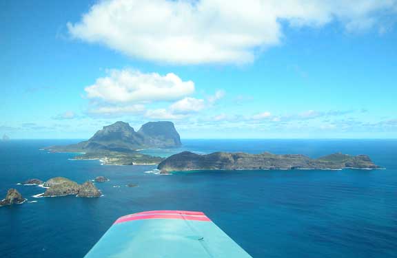
Lord Howe, Ball's Pyramid and Admiralty Islands |
Friday morning was bleak and windy. We packed up and left about 10 AM heading direct for the Island. We flew mostly above cloud until nearing our destination. We had a TAS at this stage of around 170 knots, but a ground speed of as low as 91 knots at times. This gave us some cause for thought regarding conditions at our destination. The engine hummed along beautifully with no sign of ‘automatic rough.’ Lord Howe has a reputation for producing extreme turbulence in the circuit due to strong winds and the terrain around the runway. Our aerodrome guide says “Certain wind COND. May generate SEV.TURB on the approach to the RWAY & preclude a safe LDG. The only safe course in such cases is to return to a mainland AD.”
Around forty miles out we came down to 1500 feet or so. We were soon greeted by a friendly voice calling “Yankee Bravo November, are you receiving? This is Lord Howe Maritime.” There followed a dialogue which gave us to understand that the weather was CAVOK, but there would be turbulence on approach.
|
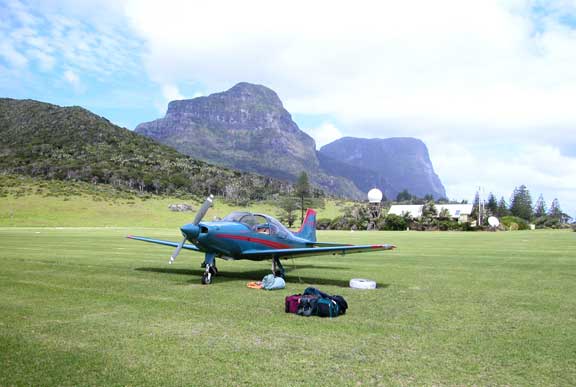
With Luggage at Lord Howe |
It was good to see the mountains of Lord Howe appearing out of the mist. On arrival the strip appeared on a narrow neck of land between the mountains to the South, and a series of ridges to the North. It was short (not for us) at 886 M or around 2,900 feet. There was a quartering cross-wind from the left on runway 10 of an indefinite number of knots. The socks were horizontal. Maritime advised us that the further into the strip we land, the less turbulence we would meet. We compromised a bit with the distance and wrestled ourselves onto the ground safely if not elegantly.
|
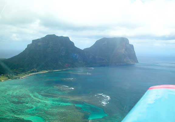
Mts. Lidgbird and Gower |
Lord Howe is a quiet and picturesque subtropical island. It almost seems that all the grass is mown regularly. Our stay was marred by high winds and rain. We got all our gear wet, and we were not able to dry it properly during this visit. The terrain is undulating with the exception of Mounts Lidgbird and Gower at the Southern end of the Island. To the West of the central part of the island is a coral lagoon enclosed by a reef. During the war a Catalina suffered engine trouble and attempted to land on the lagoon from North to South. For some reason they failed to clear the ridge at the Northen end and crashed. The remains are still on the South slope. There was only one survivor.
The preferred method of transport for visitors is bicycle; they even have a few three wheelers for the less active, or confident.
|
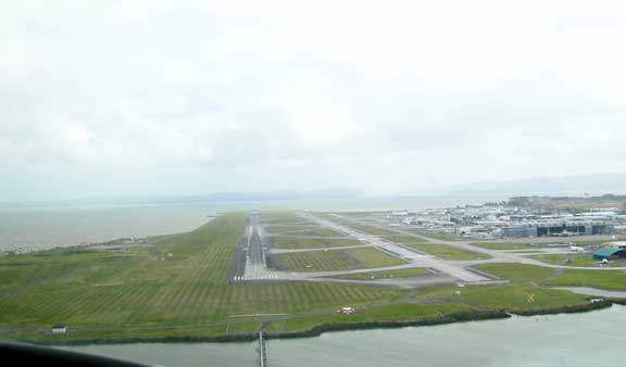
Auckland International |
![]()
![]()
|
|
Go back to Ian Ferguson